-
-
WARD LOCK RED GUIDE
Guide to the Highlands of Scotland, following the Principal Road, Railway and Steamer Routes, and indicating the Chief Tours from each Centre
Eleventh Edition.
Read more details -
WARD LOCK RED GUIDE
A Pictorial and Descriptive Guide to Bideford, Clovelly, Hartland, Barnstaple, Ilfracombe and North-West Devon. Special Section for Motorists
Thirteenth Edition, revised.
Read more details -
KELLY, ed., E. R.
County Topographies. Hampshire including the Isle of Wight. With Map engraved expressly for the Work
Read more details -
-
-
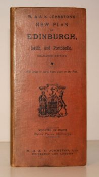
W & A K JOHNSTON
W & A K Johnstons’s New Plan of Edinburgh, Leith and Portobello [with Suburbs]. Coloured Edition. With Index to every Name given on the Plan
[Constructed from Ordnance and Private Surveys.]
Read more details -

CLUNN, Harold Philip
London Marches On. A Record of the Changes which have taken place in the Metropolis of the British Empire between the Two World Wars and much that is scheduled for Reconstruction
Read more details -

WHITBREAD and Co.
The Whitbread Library
[The set comprises 1: Whitbread's Brewery; 2: Your Local; 3: Inn-Signia; 4: The Brewer's Art; 5: Whitbread Craftsmen; 6: Inns of Kent; 7: Inns of Sport; 8: Receipts and Relishes; 9: Your Club; 10: Inn Crafts and Furnishings; 11: Word for Word.]
Read more details -

-
-

PITT-RIVERS, Michael
Dorset
A Shell Guide. Incorporating Notes by Andrew Wordsworth. [Third Edition].
Read more details -
-

HOLY TRINITY CHURCH, STRATFORD-UPON-AVON.
[Guide to] The Collegiate Church of the Holy Trinity, Stratford-upon-Avon
Read more details -
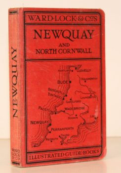
WARD LOCK RED GUIDE
A Pictorial and Descriptive Guide to Newquay, Perranporth and North Cornwall, including Tintagel, Padstow, Bude etc. Special Section for Motorists
Eleventh Edition, revised.
Read more details -
-

-

-
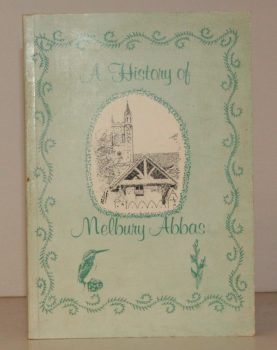
MELBURY ABBAS
A History of Melbury Abbas
Compiled by Members of the Melbury Abbas and Cann Womens Institute.
Read more details -
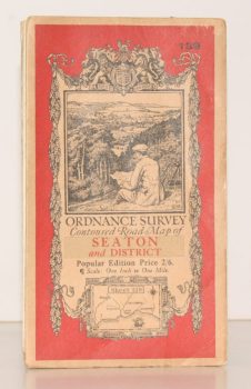
ORDNANCE SURVEY
Ordnance Survey Contoured Road Map of Seaton and District
Sheet 139. Popular Edition. Scale One Inch to One Mile
Read more details -
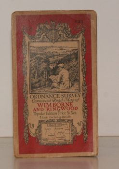
ORDNANCE SURVEY
Ordnance Survey Contoured Road Map of Wimborne and Ringwood
Sheet 131. Popular Edition. Scale One Inch to One Mile.
Read more details -
-
Topography
England
Books are listed by county following the boundaries defined in the Local Government Act 1888. Islands are included in the nearest mainland county (eg. Cornwall & Isles of Scilly).
Ireland, Scotland, Wales.
Books are arranged by country.