-
BACON, G.W.
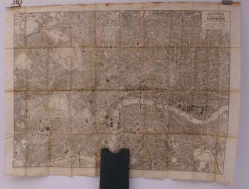
Bacon’s New Map of Central London
Divided into Half Mile Squares and Circles. Scale: Four Inches to the Mile.
Read more details -
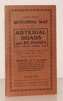
BACON'S ARTERIAL ROADS AROUND LONDON.
Large Print Motoring Map of the Arterial Roads and By-Passes around London, extending North to St. Albans, South to Epsom, East to Purfleet, West to Windsor. Scale of 1 Inch to 1.08 Miles
Showing at a glance arterial roads and by-passes built and under construction, first and second class roads with the Ministry of Transport numbers and mileage between towns.
Read more details -
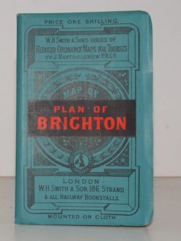
BRIGHTON.
Plan of Brighton [with comprehensive Street Index]
W. H. Smith's Series of Reduced Ordnance Survey Maps for Tourists by J. Bartholomew. [Scale: 2.5 inches to One Mile.]
Read more details -
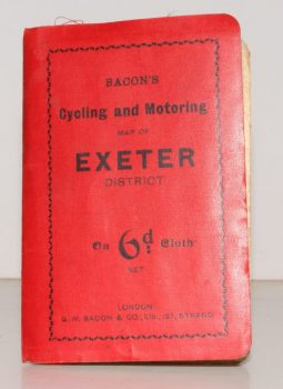
CYCLING & MOTORING MAP OF EXETER DISTRICT
Bacon’s Cycling and Motoring Map of Exeter District[Cycling and Touring] Map of 60 Miles South of London, including Worthing, Brighton, Hastings, etc.
Scale Half an Inch to One Mile.
Read more details -
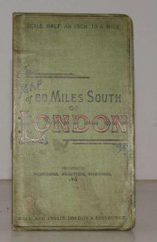
CYCLING & TOURING MAP 60 MILES SOUTH OF LONDON.
[Cycling and Touring] Map of 60 Miles South of London, including Worthing, Brighton, Hastings, etc.
Scale Half an Inch to a Mile.
Read more details -
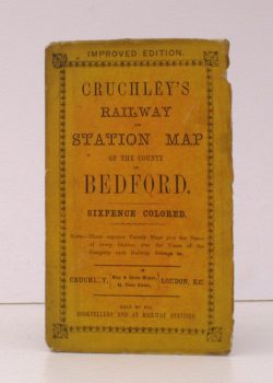
G.F.CRUCHLEY
Cruchley’s Railway and Station Map of the County of Bedford
Improved Edition. Sixpence Coloured. [Scale line: 4 inches to 7 miles].
Read more details -
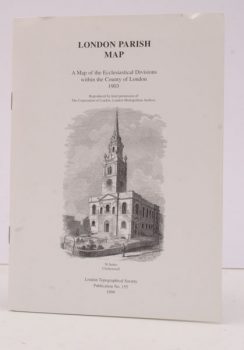
LONDON TOPOGRAPHICAL SOCIETY
London Parish Map
A Map of the Ecclesiastical Divisions within the County of London 1903. Reproduced by Permission of the Corporation of London, London Metropolitan Archive.
Read more details -
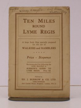
LYME REGIS
Ten Miles round Lyme Regis
A Large Scale Map specially prepared for the Use of Walkers and Ramblers.
Read more details -
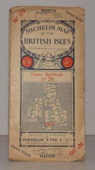
MICHELIN MAP EXETER - BARNSTAPLE
Michelin Map of the British Isles. No. 20. Exeter – Banstaple
[Scale 3.15 miles to an Inch.]
Read more details -
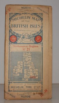
MICHELIN MAP SOUTHAMPTON - BRIGHTON
Michelin Map of the British Isles. No. 21. Southampton – Brighton
[Scale 3.15 miles to an Inch.]
Read more details -
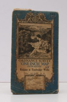
ORDANCE SURVEY
Ordnance Survey One-Inch Map
Fifth Edition. Reigate & Tunbridge Wells. Sheet 125.
Read more details -
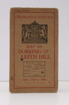
ORDANCE SURVEY
Ordnance Survey [Tourist] Map of Dorking & Leith Hill
One Inch to One Mile. ['Official Royal Arms' cover].
Read more details -
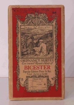
ORDNANCE SURVEY
Ordnance Survey Contoured Road Map of Bicester
Popular Edition. One Inch, Sheet 94. [Ellis Martin cover].
Read more details -
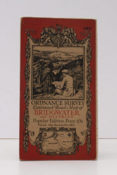
ORDNANCE SURVEY
Ordnance Survey Contoured Road Map of Bridgwater and District
Popular Edition. One Inch. Sheet 120. [Ellis Martin cover].
Read more details -
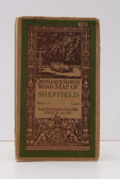
ORDNANCE SURVEY
Ordnance Survey Road Map of Sheffield
Sheet 13. Layers. Half-Inch to One Mile. [Ellis Martin cover].
Read more details -
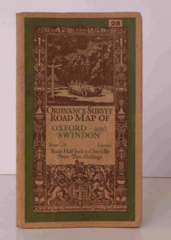
ORDNANCE SURVEY
Ordnance Survey Road Map of Oxford and Swindon
Sheet 28. Layers. alf Inch to One Mile. [Ellis Martin cover].
Read more details -
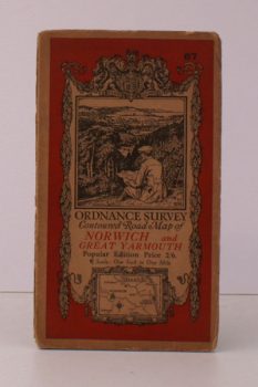
ORDNANCE SURVEY
Ordnance Survey Contoured Road Map of Norwich and Great Yarmouth
Popular Edition. One Inch. Sheet 67. [Ellis Martin cover].
Read more details -
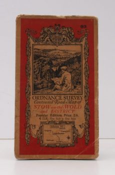
ORDNANCE SURVEY
Ordnance Survey Contoured Road Map of Stow-on-the-Wold and District
Popular Edition. One Inch, Sheet 93. [Ellis Martin cover].
Read more details -
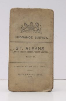
ORDNANCE SURVEY
Ordnance Survey
St. Albans. (Large Sheet Series with Layers). Sheet 29. Scale: Two Miles to One Inch.
Read more details -
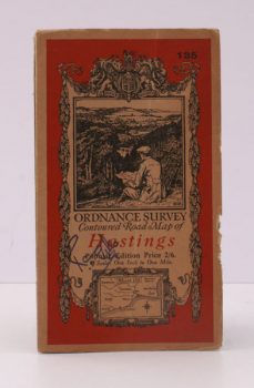
ORDNANCE SURVEY
Ordnance Survey Contoured Road Map of Hastings
Popular Edition. One Inch. Sheet 135. [Ellis Martin cover].
Read more details -
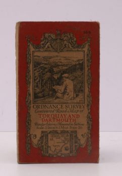
ORDNANCE SURVEY
Ordnance Survey Contoured Road Map of Torquay and Dartmouth
Popular Edition. One Inch. Sheet 145. [Ellis Martin cover].
Read more details -
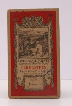
ORDNANCE SURVEY
Ordnance Survey Contoured Road Map of Carmarthen
Popular Edition. One Inch. Sheet 89. [Ellis Martin cover].
Read more details -
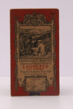
ORDNANCE SURVEY
Ordnance Survey Contoured Road Map of Land’s End and Lizard
Popular Edition. One Inch. Sheet 146. [Ellis Martin cover].
Read more details -
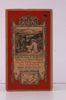
ORDNANCE SURVEY
Ordnance Survey Contoured Road Map of Clacton-on-Sea and Harwich
Popular Edition. One Inch, Sheet 98. [Ellis Martin cover].
Read more details -
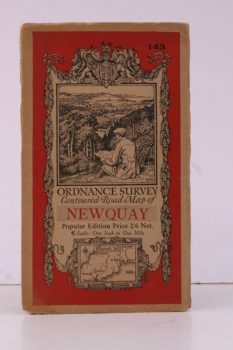
ORDNANCE SURVEY
Ordnance Survey Contoured Road Map of Newquay
Popular Edition. One Inch, Sheet 143. [Ellis Martin cover].
Read more details