-
ORDNANCE SURVEY
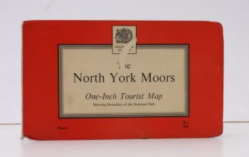
Ordnance Survey One-Inch Tourist Map. The North York Moors
Scale: One Inch to to One Mile.
Read more details -
ORDNANCE SURVEY
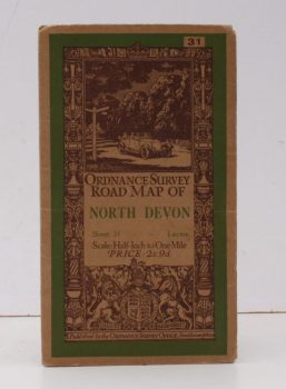
Ordnance Survey Road Map of North Devon
Sheet 31. Scale: Half-Inch to One Mile.
Read more details -
ORDNANCE SURVEY
Ordnance Survey Contoured Road Map. [Wimborne & Ringwood]
Sheet 31. Scale: One Inch to One Mile.
Read more details -
ORDNANCE SURVEY
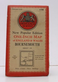
Ordnance Survey One-Inch Map of Bournemouth
New Popular Edition. Sheet 179. Scale: One Inch to to One Mile.
Read more details -
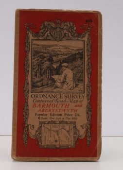
ORDNANCE SURVEY
Ordnance Survey Contoured Road Map of Barmouth and Aberystwyth
Popular Edition. Sheet 68. Scale: One Inch to to One Mile.
Read more details -
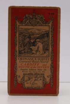
ORDNANCE SURVEY
Ordnance Survey Contoured Road Map of Cardiff and Mouth of the Severn
Popular Edition. Sheet 110. Scale: One Inch to to One Mile.
Read more details -
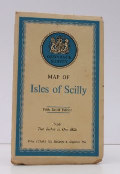
ORDNANCE SURVEY
Ordnance Survey Map of Isles of Scilly
Fifth Relief Edition. Scale: Two Inches to One Mile.
Read more details -
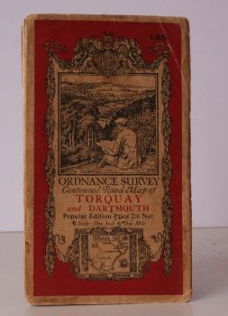
ORDNANCE SURVEY
Ordnance Survey One-Inch Map. Torquay and Dartmouth
Popular Edition. Sheet 145. Scale: One Inch to to One Mile.
Read more details -
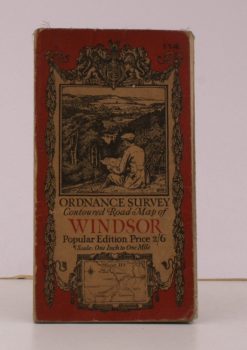
ORDNANCE SURVEY
Ordnance Survey Contoured Road Map of Windsor
Sheet 114. Popular Edition. Scale: One Inch to to One Mile.
Read more details -

ORDNANCE SURVEY
[Map of] Roman Britain. Scale 1:625 000 about Ten Miles to One Inch
[Fourth Edition.]
Read more details -
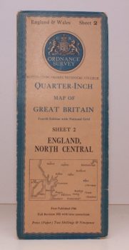
ORDNANCE SURVEY
Quarter-Inch Map of Great Britain. Sheet 2. England, North Central
Fourth Edition with National Grid. [Scale: Quarter-Inch to One Mile].
Read more details -
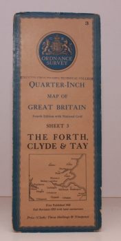
ORDNANCE SURVEY
Quarter-Inch Map of Great Britain. Sheet 3. The Forth, Clyde and Tay
Fourth Edition with National Grid. [Scale: Quarter-Inch to One Mile].
Read more details -
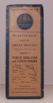
ORDNANCE SURVEY
Quarter-Inch Map of Great Britain. Sheet 6. North Midlands and Lincolnshire
Fourth Edition with National Grid. [Scale: Quarter-Inch to One Mile].
Read more details -
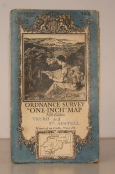
ORDNANCE SURVEY
Ordnance Survey One-Inch Map. Truro and St. Austell
Sheet 143. Fifth Edition. Scale: One Inch to to One Mile.
Read more details -
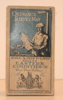
ORDNANCE SURVEY
Ordnance Survey One Quarter-Inch Map. Eastern Counties (N)
Sheet 6. [Third Edition.] Scale: One-Quarter Inch to to One Mile.
Read more details -
ORDNANCE SURVEY
Ordnance Survey One-Inch Map. Stratford-on-Avon and District
Popular Edition. Sheet 82. Scale: One Inch to to One Mile.
Read more details -
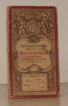
ORDNANCE SURVEY
Ordnance Survey One-Inch Map. Macclesfield and District.
Coloured Edition. Sheet 45. Scale: One Inch to to One Mile.
Read more details -
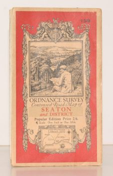
ORDNANCE SURVEY
Ordnance Survey Contoured Road Map of Seaton and District
Sheet 139. Popular Edition. Scale One Inch to One Mile
Read more details -
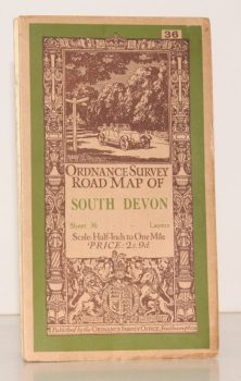
ORDNANCE SURVEY
Ordnance Survey Road Map of South Devon
Sheet 36. Layered Edition. Scale Half-Inch Inch to One Mile
Read more details -
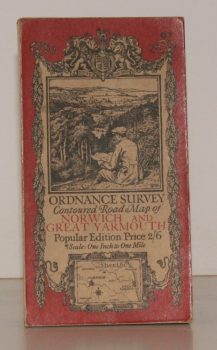
ORDNANCE SURVEY
Ordnance Survey Contoured Road Map of Norwich and Great Yarmouth
Sheet 67. Popular Edition. Scale One Inch to One Mile.
Read more details -
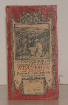
ORDNANCE SURVEY
Ordnance Survey Contoured Road Map of Winchester and District
Sheet 123. Popular Edition. Scale One Inch to One Mile.
Read more details -
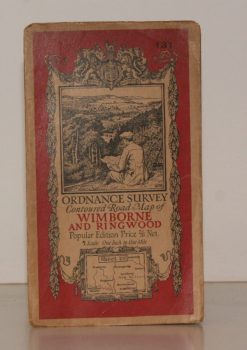
ORDNANCE SURVEY
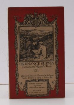
Ordnance Survey Contoured Road Map of Wimborne and Ringwood
Sheet 131. Popular Edition. Scale One Inch to One Mile.
Read more details -
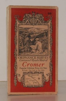
ORDNANCE SURVEY
Ordnance Survey Contoured Road Map of Cromer
Sheet 58. Popular Edition. Scale One Inch to One Mile.
Read more details -
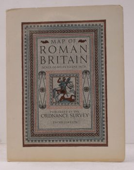
ORDNANCE SURVEY
Map of Roman Britain (Third Edition)
Scale: Sixteen Miles to One Inch.
Read more details -
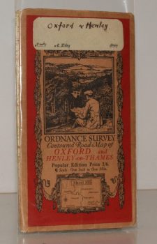
ORDNANCE SURVEY
Ordnance Survey Contoured Road Map of Oxford and Henley-on-Thames
Popular Edition. Sheet 105. Scale: One Inch to to One Mile.
Read more details
Topography
England
Books are listed by county following the boundaries defined in the Local Government Act 1888. Islands are included in the nearest mainland county (eg. Cornwall & Isles of Scilly).
Ireland, Scotland, Wales.
Books are arranged by country.