-
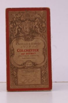
ORDNANCE SURVEY
Ordnance Survey Map of Colchester and District
Coloured Edition. One Inch, Sheet 99. [Ellis Martin cover].
Read more details -
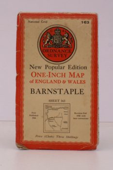
ORDNANCE SURVEY
One-Inch Map. Barnstaple. Sheet 163
New Popu ar Edition. [With Ellis Martin cover].
Read more details -
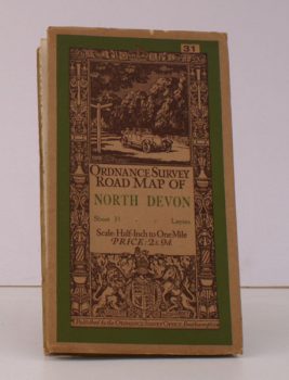
ORDNANCE SURVEY
Ordnance Survey Road Map of North Devon
Sheet 31. Layers. Scale: Half-Inch to One Mile
Read more details -
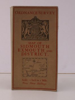
ORDNANCE SURVEY
Ordnance Survey Map of Sidmouth, Exmouth and District
Scale: One Inch to to One Mile.
Read more details -
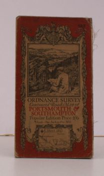
ORDNANCE SURVEY
Ordnance Survey Contoured Road Map of Portsmouth and Southampton
Sheet 132. Popular Edition. Scale: One Inch to to One Mile.
Read more details -
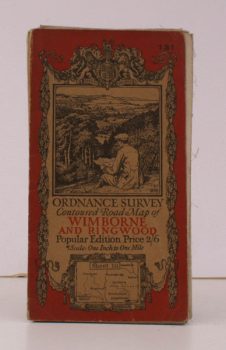
ORDNANCE SURVEY
Ordnance Survey Contoured Road Map of Wimborne and Ringwood
Sheet 131 . Popular Edition. Scale: One Inch to to One Mile.
Read more details -
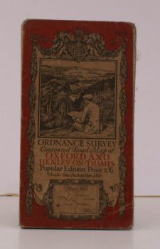
ORDNANCE SURVEY
Ordnance Survey Contoured Road Map of Oxford and Henley-on-Thames
Sheet 105. Popular Edition. Scale: One Inch to to One Mile.
Read more details -
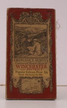
ORDNANCE SURVEY
Ordnance Survey Contoured Road Map of Winchester and District
Sheet 123. Popular Edition. Scale: One Inch to to One Mile.
Read more details -
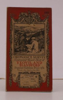
ORDNANCE SURVEY
Ordnance Survey Contoured Road Map of Yeovil and Blandford
Sheet 130. Popular Edition. Scale: One Inch to to One Mile.
Read more details -
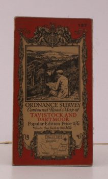
ORDNANCE SURVEY
Ordnance Survey Contoured Road Map of Tavistock and Dartmoor
Sheet 137. Popular Edition. Scale: One Inch to to One Mile.
Read more details -
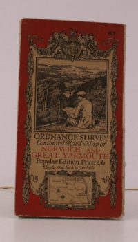
ORDNANCE SURVEY
Ordnance Survey Contoured Road Map of Norwich and Great Yarmouth
Sheet 67. Popular Edition. Scale: One Inch to to One Mile.
Read more details -
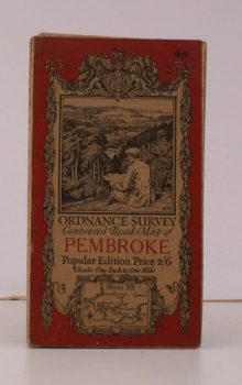
ORDNANCE SURVEY
Ordnance Survey Contoured Road Map of Pembroke and Tenby
Sheet 99. Popular Edition. Scale: One Inch to to One Mile.
Read more details -
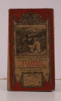
ORDNANCE SURVEY
Ordnance Survey Contoured Road Map of Reading and Newbury
Sheet 113. Popular Edition. Scale: One Inch to to One Mile.
Read more details -
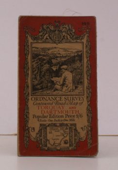
ORDNANCE SURVEY
Ordnance Survey Contoured Road Map of Torquay and Dartmouth
Sheet 145. Popular Edition. Scale: One Inch to to One Mile.
Read more details -
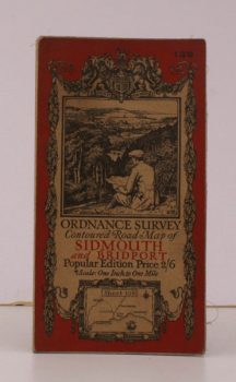
ORDNANCE SURVEY
Ordnance Survey Contoured Road Map of Sidmouth and Bridport
Sheet 139. Popular Edition. Scale: One Inch to to One Mile.
Read more details -
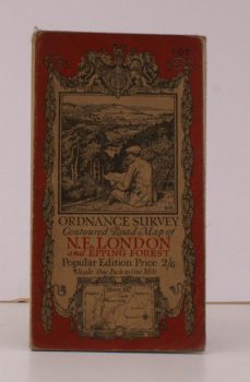
ORDNANCE SURVEY
Ordnance Survey Contoured Road Map of N.E. London and Epping Forest
Sheet 107. Popular Edition. Scale: One Inch to to One Mile.
Read more details -
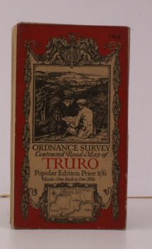
ORDNANCE SURVEY
Ordnance Survey Contoured Road Map of Truro and St. Austell
Sheet 143. Popular Edition. Scale: One Inch to to One Mile.
Read more details -
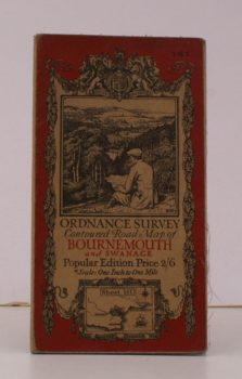
ORDNANCE SURVEY
Ordnance Survey Contoured Road Map of Bournemouth and Swanage
Sheet 141. Scale: One Inch to to One Mile.
Read more details -
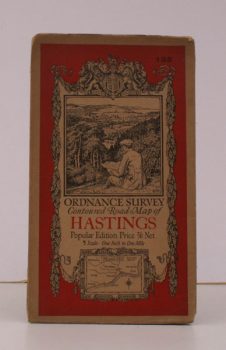
ORDNANCE SURVEY
Ordnance Survey Contoured Road Map of Hastings
Sheet 135. Scale: One Inch to to One Mile.
Read more details -
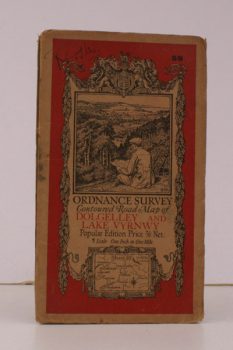
ORDNANCE SURVEY
Ordnance Survey Contoured Road Map of Dolgelley and Lake Vwynwy
Sheet 59. Scale: One Inch to to One Mile.
Read more details -
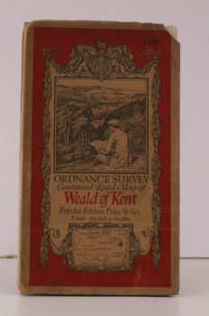
ORDNANCE SURVEY
Ordnance Survey Contoured Road Map of Weald of Kent
Sheet 126. Scale: One Inch to to One Mile.
Read more details -
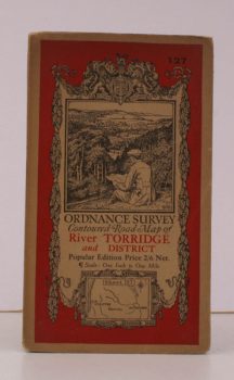
ORDNANCE SURVEY
Ordnance Survey Contoured Road Map of River Torridge and District
Sheet 127. Scale: One Inch to to One Mile.
Read more details -
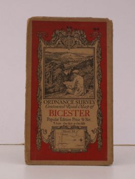
ORDNANCE SURVEY
Ordnance Survey Contoured Road Map of Bicester
Sheet 94. Scale: One Inch to to One Mile.
Read more details -
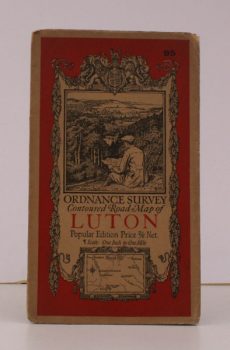
ORDNANCE SURVEY
Ordnance Survey Contoured Road Map of Luton
Sheet 95. Scale: One Inch to to One Mile.
Read more details -
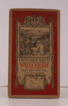
ORDNANCE SURVEY
Ordnance Survey Contoured Road Map of Wells, Frome and District
Sheet 121. Scale: One Inch to to One Mile.
Read more details
Topography
England
Books are listed by county following the boundaries defined in the Local Government Act 1888. Islands are included in the nearest mainland county (eg. Cornwall & Isles of Scilly).
Ireland, Scotland, Wales.
Books are arranged by country.