-
-
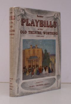
ODELL, Mary Theresa
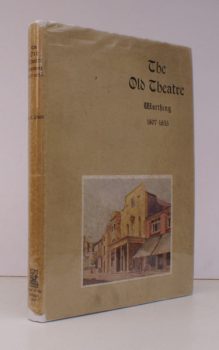
Some Playbills of the Old Theatre, Worthing
The Theatre Royal, 1807-1855.
Read more details -
-
-
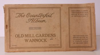
OLD MILL GARDENS, WANNOCK.
Old Mill Gardens, Wannock. The Counterfoil Album
Containing 6 Cabinet Views and 6 Postcards, printed in sepia Photogravure.
Read more details -
-
-
-
-
OLIVEY, H.P.
North Curry: Ancient Manor and Hundred
Notes upon the History of the three Parishes: North Curry, Stoke St. Gregory, West Hatch contained therein.
Read more details -
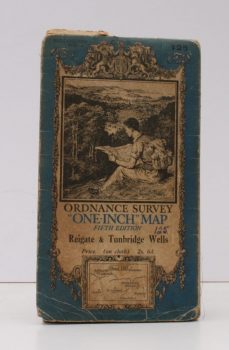
ORDANCE SURVEY
Ordnance Survey One-Inch Map
Fifth Edition. Reigate & Tunbridge Wells. Sheet 125.
Read more details -
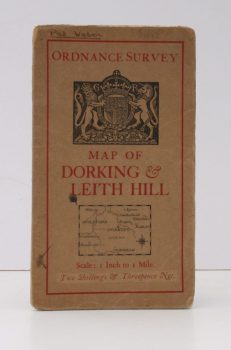
ORDANCE SURVEY
Ordnance Survey [Tourist] Map of Dorking & Leith Hill
One Inch to One Mile. ['Official Royal Arms' cover].
Read more details -
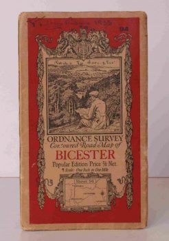
ORDNANCE SURVEY
Ordnance Survey Contoured Road Map of Bicester
Popular Edition. One Inch, Sheet 94. [Ellis Martin cover].
Read more details -
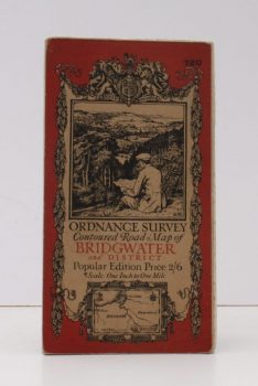
ORDNANCE SURVEY
Ordnance Survey Contoured Road Map of Bridgwater and District
Popular Edition. One Inch. Sheet 120. [Ellis Martin cover].
Read more details -
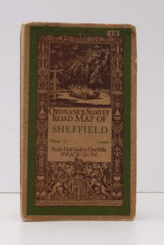
ORDNANCE SURVEY
Ordnance Survey Road Map of Sheffield
Sheet 13. Layers. Half-Inch to One Mile. [Ellis Martin cover].
Read more details -
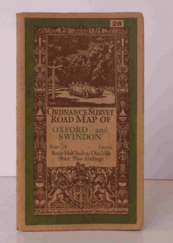
ORDNANCE SURVEY
Ordnance Survey Road Map of Oxford and Swindon
Sheet 28. Layers. alf Inch to One Mile. [Ellis Martin cover].
Read more details -
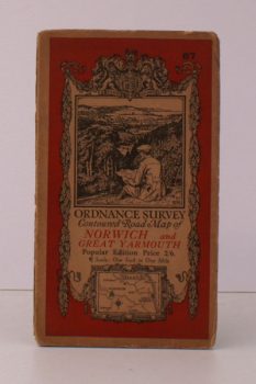
ORDNANCE SURVEY
Ordnance Survey Contoured Road Map of Norwich and Great Yarmouth
Popular Edition. One Inch. Sheet 67. [Ellis Martin cover].
Read more details -
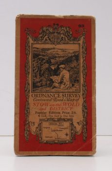
ORDNANCE SURVEY
Ordnance Survey Contoured Road Map of Stow-on-the-Wold and District
Popular Edition. One Inch, Sheet 93. [Ellis Martin cover].
Read more details -
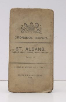
ORDNANCE SURVEY
Ordnance Survey
St. Albans. (Large Sheet Series with Layers). Sheet 29. Scale: Two Miles to One Inch.
Read more details -
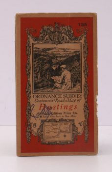
ORDNANCE SURVEY
Ordnance Survey Contoured Road Map of Hastings
Popular Edition. One Inch. Sheet 135. [Ellis Martin cover].
Read more details -
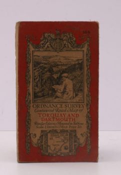
ORDNANCE SURVEY
Ordnance Survey Contoured Road Map of Torquay and Dartmouth
Popular Edition. One Inch. Sheet 145. [Ellis Martin cover].
Read more details -
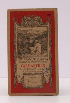
ORDNANCE SURVEY
Ordnance Survey Contoured Road Map of Carmarthen
Popular Edition. One Inch. Sheet 89. [Ellis Martin cover].
Read more details -
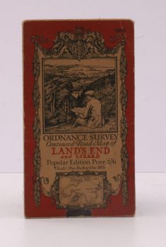
ORDNANCE SURVEY
Ordnance Survey Contoured Road Map of Land’s End and Lizard
Popular Edition. One Inch. Sheet 146. [Ellis Martin cover].
Read more details -
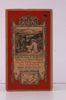
ORDNANCE SURVEY
Ordnance Survey Contoured Road Map of Clacton-on-Sea and Harwich
Popular Edition. One Inch, Sheet 98. [Ellis Martin cover].
Read more details -
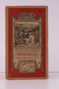
ORDNANCE SURVEY
Ordnance Survey Contoured Road Map of Newquay
Popular Edition. One Inch, Sheet 143. [Ellis Martin cover].
Read more details
Topography
England
Books are listed by county following the boundaries defined in the Local Government Act 1888. Islands are included in the nearest mainland county (eg. Cornwall & Isles of Scilly).
Ireland, Scotland, Wales.
Books are arranged by country.