-
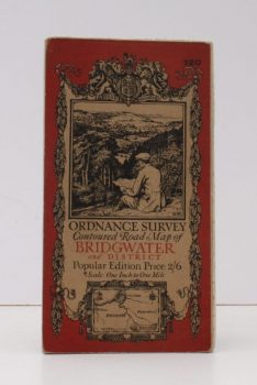
ORDNANCE SURVEY
Ordnance Survey Contoured Road Map of Bridgwater and District
Popular Edition. One Inch. Sheet 120. [Ellis Martin cover].
Read more details -
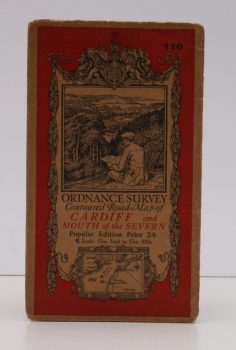
ORDNANCE SURVEY
Ordnance Survey Contoured Road Map of Cardiff and Mouth of the Severn
Popular Edition. Sheet 110. Scale: One Inch to to One Mile.
Read more details -
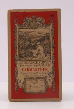
ORDNANCE SURVEY
Ordnance Survey Contoured Road Map of Carmarthen
Popular Edition. One Inch. Sheet 89. [Ellis Martin cover].
Read more details -
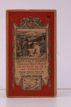
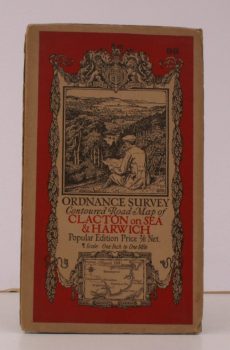
ORDNANCE SURVEY
Ordnance Survey Contoured Road Map of Clacton-on-Sea and Harwich
Popular Edition. One Inch, Sheet 98. [Ellis Martin cover].
Read more details -
ORDNANCE SURVEY
Ordnance Survey Contoured Road Map of Clacton-on-Sea and Harwich
Sheet 98. Scale: One Inch to to One Mile.
Read more details -
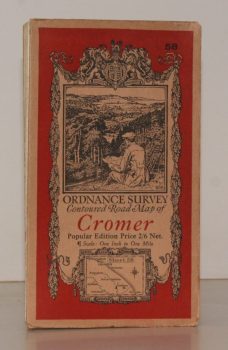
ORDNANCE SURVEY
Ordnance Survey Contoured Road Map of Cromer
Sheet 58. Popular Edition. Scale One Inch to One Mile.
Read more details -
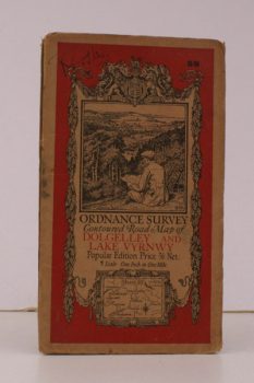
ORDNANCE SURVEY
Ordnance Survey Contoured Road Map of Dolgelley and Lake Vwynwy
Sheet 59. Scale: One Inch to to One Mile.
Read more details -
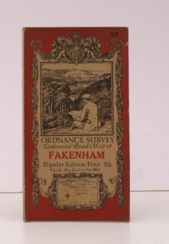
ORDNANCE SURVEY
Ordnance Survey Contoured Road Map of Fakenham
Sheet 57. Popular Edition. Scale: One Inch to One Mile.
Read more details -
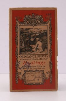
ORDNANCE SURVEY
Ordnance Survey Contoured Road Map of Hastings
Popular Edition. One Inch. Sheet 135. [Ellis Martin cover].
Read more details -
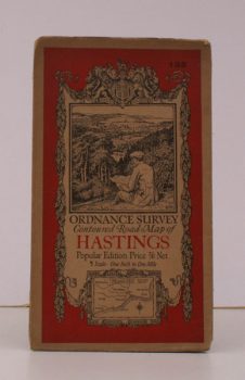
ORDNANCE SURVEY
Ordnance Survey Contoured Road Map of Hastings
Sheet 135. Scale: One Inch to to One Mile.
Read more details -
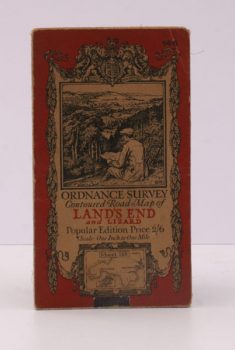
ORDNANCE SURVEY
Ordnance Survey Contoured Road Map of Land’s End and Lizard
Popular Edition. One Inch. Sheet 146. [Ellis Martin cover].
Read more details -
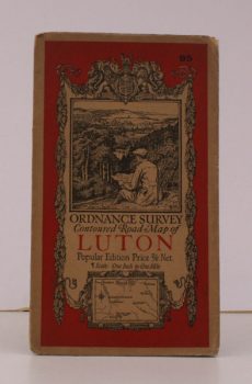
ORDNANCE SURVEY
Ordnance Survey Contoured Road Map of Luton
Sheet 95. Scale: One Inch to to One Mile.
Read more details -
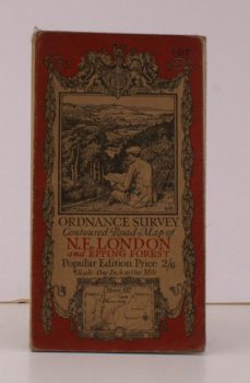
ORDNANCE SURVEY
Ordnance Survey Contoured Road Map of N.E. London and Epping Forest
Sheet 107. Popular Edition. Scale: One Inch to to One Mile.
Read more details -
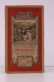
ORDNANCE SURVEY
Ordnance Survey Contoured Road Map of Newquay
Popular Edition. One Inch, Sheet 143. [Ellis Martin cover].
Read more details -
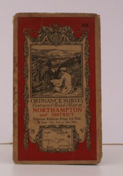
ORDNANCE SURVEY
Ordnance Survey Contoured Road Map of Northampton and District
Sheet 83. Scale: One Inch to to One Mile.
Read more details -
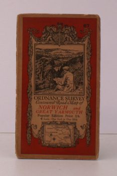
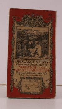
ORDNANCE SURVEY
Ordnance Survey Contoured Road Map of Norwich and Great Yarmouth
Popular Edition. One Inch. Sheet 67. [Ellis Martin cover].
Read more details -
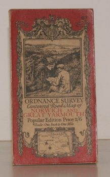
ORDNANCE SURVEY
Ordnance Survey Contoured Road Map of Norwich and Great Yarmouth
Sheet 67. Popular Edition. Scale: One Inch to to One Mile.
Read more details -
ORDNANCE SURVEY
Ordnance Survey Contoured Road Map of Norwich and Great Yarmouth
Sheet 67. Popular Edition. Scale One Inch to One Mile.
Read more details -
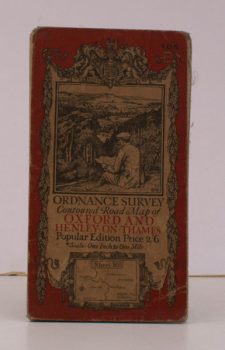
ORDNANCE SURVEY
Ordnance Survey Contoured Road Map of Oxford and Henley-on-Thames
Sheet 105. Popular Edition. Scale: One Inch to to One Mile.
Read more details -
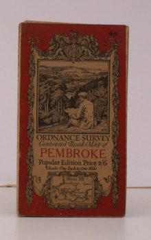
ORDNANCE SURVEY
Ordnance Survey Contoured Road Map of Pembroke and Tenby
Sheet 99. Popular Edition. Scale: One Inch to to One Mile.
Read more details -
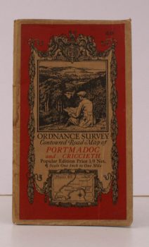
ORDNANCE SURVEY
Ordnance Survey Contoured Road Map of Portmadoc and Criccieth
Sheet 49. Scale: One Inch to to One Mile.
Read more details -
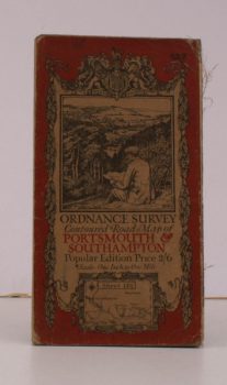
ORDNANCE SURVEY
Ordnance Survey Contoured Road Map of Portsmouth and Southampton
Sheet 132. Popular Edition. Scale: One Inch to to One Mile.
Read more details -
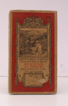
ORDNANCE SURVEY
Ordnance Survey Contoured Road Map of Reading and Newbury
Sheet 113. Popular Edition. Scale: One Inch to to One Mile.
Read more details -
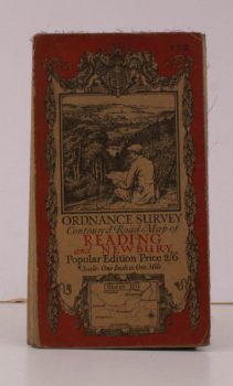
ORDNANCE SURVEY
Ordnance Survey Contoured Road Map of Reading and Newbury
Popular Edition. Sheet 113 Scale: One Inch to One Mile.
Read more details -
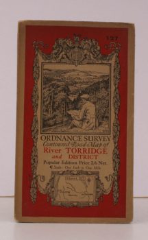
ORDNANCE SURVEY
Ordnance Survey Contoured Road Map of River Torridge and District
Sheet 127. Scale: One Inch to to One Mile.
Read more details
Topography
England
Books are listed by county following the boundaries defined in the Local Government Act 1888. Islands are included in the nearest mainland county (eg. Cornwall & Isles of Scilly).
Ireland, Scotland, Wales.
Books are arranged by country.