-
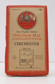
ORDNANCE SURVEY
Ordnance Survey One-Inch Map. Chichester
New Popular Edition. Sheet 181. Full revision 1930. Roads 1947 with later corrections.
Read more details -
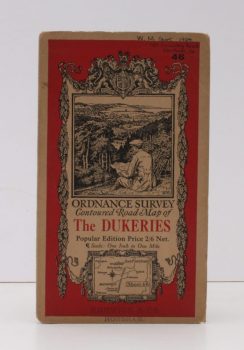
ORDNANCE SURVEY
Ordnance Survey Contoured Road Map of The Dukeries
Popular Edition. Sheet 46 Scale: One Inch to One Mile.
Read more details -
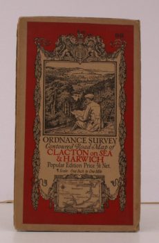
ORDNANCE SURVEY
Ordnance Survey Contoured Road Map of Clacton-on-Sea and Harwich
Sheet 98. Scale: One Inch to to One Mile.
Read more details -
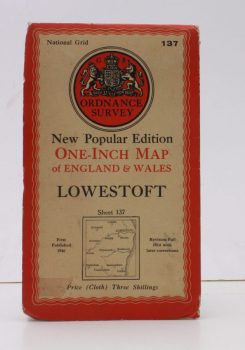
ORDNANCE SURVEY
Ordnance Survey One-Inch Map of Lowestoft
New Popular Edition. Sheet 137. Scale: One Inch to to One Mile. [First Issue thus].
Read more details -
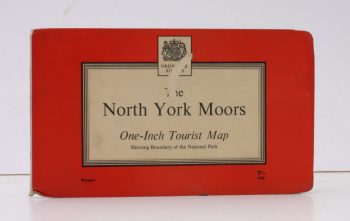
ORDNANCE SURVEY
Ordnance Survey One-Inch Tourist Map. The North York Moors
Scale: One Inch to to One Mile.
Read more details -
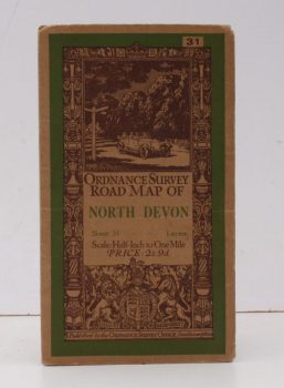
ORDNANCE SURVEY
Ordnance Survey Road Map of North Devon
Sheet 31. Scale: Half-Inch to One Mile.
Read more details -
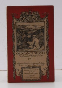
ORDNANCE SURVEY
Ordnance Survey Contoured Road Map. [Wimborne & Ringwood]
Sheet 31. Scale: One Inch to One Mile.
Read more details -
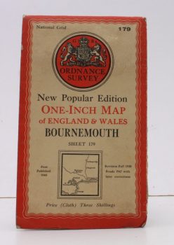
ORDNANCE SURVEY
Ordnance Survey One-Inch Map of Bournemouth
New Popular Edition. Sheet 179. Scale: One Inch to to One Mile.
Read more details -
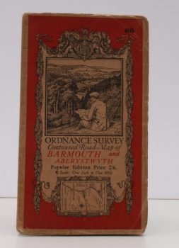
ORDNANCE SURVEY
Ordnance Survey Contoured Road Map of Barmouth and Aberystwyth
Popular Edition. Sheet 68. Scale: One Inch to to One Mile.
Read more details -
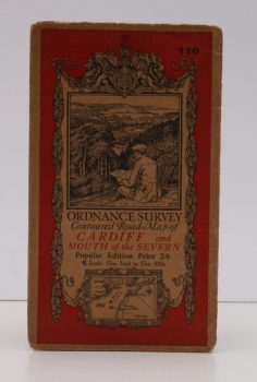
ORDNANCE SURVEY
Ordnance Survey Contoured Road Map of Cardiff and Mouth of the Severn
Popular Edition. Sheet 110. Scale: One Inch to to One Mile.
Read more details -
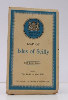
ORDNANCE SURVEY
Ordnance Survey Map of Isles of Scilly
Fifth Relief Edition. Scale: Two Inches to One Mile.
Read more details -
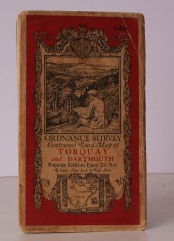
ORDNANCE SURVEY
Ordnance Survey One-Inch Map. Torquay and Dartmouth
Popular Edition. Sheet 145. Scale: One Inch to to One Mile.
Read more details -
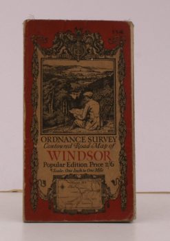
ORDNANCE SURVEY
Ordnance Survey Contoured Road Map of Windsor
Sheet 114. Popular Edition. Scale: One Inch to to One Mile.
Read more details -

ORDNANCE SURVEY
[Map of] Roman Britain. Scale 1:625 000 about Ten Miles to One Inch
[Fourth Edition.]
Read more details -
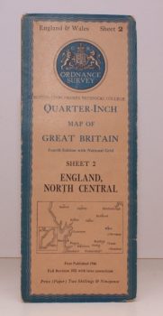
ORDNANCE SURVEY
Quarter-Inch Map of Great Britain. Sheet 2. England, North Central
Fourth Edition with National Grid. [Scale: Quarter-Inch to One Mile].
Read more details -
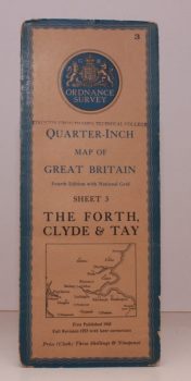
ORDNANCE SURVEY
Quarter-Inch Map of Great Britain. Sheet 3. The Forth, Clyde and Tay
Fourth Edition with National Grid. [Scale: Quarter-Inch to One Mile].
Read more details -
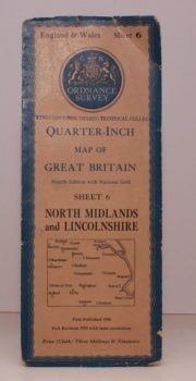
ORDNANCE SURVEY
Quarter-Inch Map of Great Britain. Sheet 6. North Midlands and Lincolnshire
Fourth Edition with National Grid. [Scale: Quarter-Inch to One Mile].
Read more details -
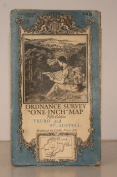
ORDNANCE SURVEY
Ordnance Survey One-Inch Map. Truro and St. Austell
Sheet 143. Fifth Edition. Scale: One Inch to to One Mile.
Read more details -
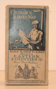
ORDNANCE SURVEY
Ordnance Survey One Quarter-Inch Map. Eastern Counties (N)
Sheet 6. [Third Edition.] Scale: One-Quarter Inch to to One Mile.
Read more details -
ORDNANCE SURVEY
Ordnance Survey One-Inch Map. Stratford-on-Avon and District
Popular Edition. Sheet 82. Scale: One Inch to to One Mile.
Read more details -
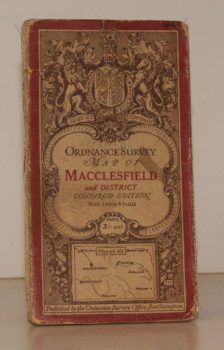
ORDNANCE SURVEY
Ordnance Survey One-Inch Map. Macclesfield and District.
Coloured Edition. Sheet 45. Scale: One Inch to to One Mile.
Read more details -
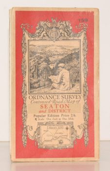
ORDNANCE SURVEY
Ordnance Survey Contoured Road Map of Seaton and District
Sheet 139. Popular Edition. Scale One Inch to One Mile
Read more details -
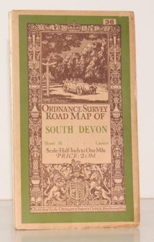
ORDNANCE SURVEY
Ordnance Survey Road Map of South Devon
Sheet 36. Layered Edition. Scale Half-Inch Inch to One Mile
Read more details -
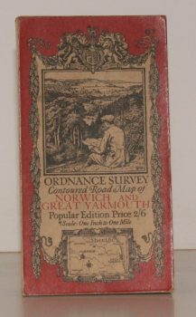
ORDNANCE SURVEY
Ordnance Survey Contoured Road Map of Norwich and Great Yarmouth
Sheet 67. Popular Edition. Scale One Inch to One Mile.
Read more details -
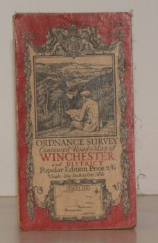
ORDNANCE SURVEY
Ordnance Survey Contoured Road Map of Winchester and District
Sheet 123. Popular Edition. Scale One Inch to One Mile.
Read more details