-
-
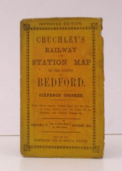
G.F.CRUCHLEY
Cruchley’s Railway and Station Map of the County of Bedford
Improved Edition. Sixpence Coloured. [Scale line: 4 inches to 7 miles].
Read more details -

WARTER, John Wood
The Seaboard and the Down
Or, My Parish in the South. By an old Vicar.
Read more details -

SUFFLING, Ernest R.
Sun Pictures of the Norfolk Broads
One Hundred Photographs from Nature of the Rivers and Broads of Norfolk and Suffolk. By Payne Jennings. With Letterpress Description by Ernest R. Suffling. Second Edition.
Read more details -

CLARKE, S.R.
The New Lancashire Gazetteer
Or Topographical Dictionary, containing an Accurate Description of the Hundreds, Boroughs, Market Towns, Parishes, Townships and Hamlets of the County Palatine of Lancaster.
Read more details -

BOASE (ed.), C.W.
Register of the University of Oxford
[Vol. I: 1449-63, 1505-71; Vol. II: 1571-1622].
Read more details -
BULLAR, John
A Companion in a Tour round Southampton
Fourth Edition, improved and enlarged.
Read more details -
-

LLOYD, Thomas
The Lost Houses of Wales
A Survey of Country Houses in Wales demolished since c.1900.
Read more details -
-

NOBLE, Joseph
The Gazetteer of Lincolnshire, Historical, Topographical and Antiquarian; containing a complete List of every Town, Village and Hamlet in the County, arranged and divided into Wapentakes [with Population and list of Parliament]
Read more details -
ST. ALBANS
History of Verulam and St. Alban’s
Containing an Historical Account of the Decline of Verulam and Origin of St. Albans, and of the Present State of the Town, the Abbey and other Churches. [Sole Edition].
Read more details -

-
-
-
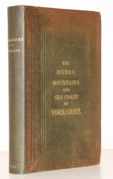
PHILLIPS FRS, John
The Rivers, Mountains, and Sea-Coast of Yorkshire with Essays on the Climate, Scenery, and Ancient Inhabitants of the County
Read more details -
STRUTHERS, J.
The History of Scotland from the Union to the Abolition of the heritable Jurisdiction in MDCCXLVIII
Read more details -
-
DEFOE, Daniel
A Tour thro’ the whole Island of Great Britain
With which is included, a Set of Maps of England and Wales, divided into Counties; and a Map of Scotland. Composed by Hermann Moll. With an Introduction FIRST COMPLETE RE-ISSUE.
Read more details -
-

SEYMOUR], [Francis Jane
A Hundred Years of Bray and its Neighbourhood from 1770 to 1870
By an Old Inhabitant.
Read more details -
WEST], [W.
Tavern Anecdotes, and Reminiscences of the Origin of Signs, Clubs, Coffee-Houses, Streets, City Companies, Wards, etc, intended as a Lounge-Book for Londoners and their Country Cousins
By One of the Old School.
Read more details -
MARCHAM, W.B.
Court Rolls of the Bishop of London’s Manor of Hornsey
Transcribed and edited by William McBeath Marcham and Frank Marcham.
Read more details -

GLEW, Edward Lees
History of the Borough and Foreign of Walsall, in the County of Stafford
Read more details -
Topography
England
Books are listed by county following the boundaries defined in the Local Government Act 1888. Islands are included in the nearest mainland county (eg. Cornwall & Isles of Scilly).
Ireland, Scotland, Wales.
Books are arranged by country.