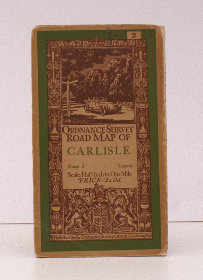
Ordnance Survey Road Map of Carlisle
ORDNANCE SURVEY
Sheet 2. Layers. Scale: Half-Inch to One Mile.
BRIGHT, CLEAN COPY OF THE 1929 ISSUE
Published: Ordnance Survey Southampton, [1929]
Stock code: 32200
Price: £26.00
Folding coloured map on cloth measuring 22 x 30 ins (approx. 56 x 76 cms) folding in 21 panels to 7.0 x 4.0 ins (approx. 17.7 x 10.1 cms); original pictorial card wrappers, neat stamp on rear wrapper, a very good, bright, clean copy
The Half-Inch Layered series with striking 'car and signpost' cover by Ellis Martin was first issued in in 1913; Sheet 2 was first published in that year. The cover is 'car and signpost' in green and brown with green sheet name. This is the 1929 revision. SCARCE IN THIS CONDITION. Browne, 12.2a.