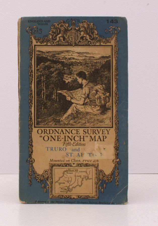
Ordnance Survey ‘One-Inch’ Map. Fifth Edition. Truro and St. Austell
ORDNANCE SURVEY
Sheet 143. [Scale: One Inch to One Mile].
BRIGHT, CLEAN COPY OF THE 1936 REVISION
Published: Ordnance Survey Southampton, [1936]
Stock code: 32253
Price: £22.00
Folding coloured map on cloth measuring 29 x 34 ins (approx. 73 x 86 cms) folding in 32 panels to 7.5 x 4.5 ins (approx. 17.7 x 10.1 cms); original pictorial card wrappers, small label scar on front wrapper else a very good, bright, clean copy.
The One-Inch Fifth Edition began publication in 1932; Sheet 143 was first issued in 1934. This is the 1936 revision. The cover is Ellis Martin's 'hiker on hillside' in blue and black with location map. SCARCE IN THIS CONDITION. Browne, 23.2.ab.