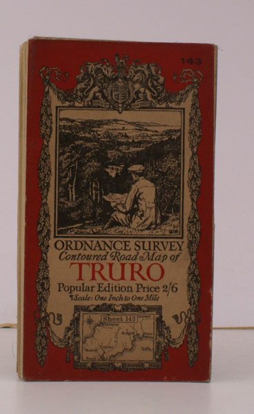
Ordnance Survey Contoured Road Map of Truro and St. Austell
ORDNANCE SURVEY
Sheet 143. Popular Edition. Scale: One Inch to to One Mile.
BRIGHT, CLEAN COPY
Published: Ordnance Survey Southampton, [1927]
Stock code: 29869
Price: £16.00
Folding coloured map on cloth measuring 26 x 35 ins (approx. 66.0 x 88.0 cms) folding in 36 panels to 7.0 x 4.0 ins (approx. 17.7 x 10.1 cms); original pictorial card wrappers, one or two small stains on map surface else a bright, clean copy.
The famous Popular Edition One Inch series with striking 'cyclist' artwork by Ellis Martin was first issued in 1918. This is the 1927 revision. The covers are black with red sheet name and location map. Browne, 11.1.a