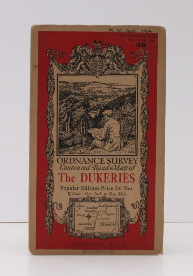
Ordnance Survey Contoured Road Map of The Dukeries
ORDNANCE SURVEY
Popular Edition. Sheet 46 Scale: One Inch to One Mile.
BRIGHT, CLEAN COPY
Published: Ordnance Survey Southampton, [1932]
Stock code: 33594
Price: £14.00
Folding coloured map on cloth measuring 22 x 29 ins (approx. 59 x 74 cms) folding in 21 panels to 7.0 x 4.5 ins (approx. 17.7 x 10.5 cms), small signature and stamp on front wrapper; original pictorial card wrappers, a very good, bright, clean copy
First issued in 1923. This is the 1932 reissue. The cover is Ellis Martin's 'cyclist on hillside' in dark red and black with location map. Browne, 11.2.a.