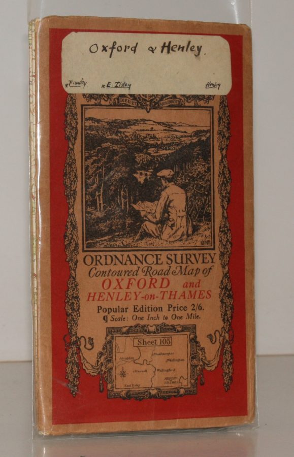
Ordnance Survey Contoured Road Map of Oxford and Henley-on-Thames
ORDNANCE SURVEY
Popular Edition. Sheet 105. Scale: One Inch to to One Mile.
UNUSUALLY BRIGHT, CLEAN COPY
Published: Ordnance Survey Southampton, [c. 1934]
Stock code: 51482
Price: £24.00
Folding coloured map on cloth measuring 22 x 30 ins (approx. 56 x 76 cms) folding in 21 panels to 7.0 x 4.0 ins (approx. 17.7 x 10.1 cms); original pictorial card wrappers, sticker on front wrapper else an unusually bright, crisp copy.
The famous Popular Edition One Inch series with striking 'cyclist' artwork by Ellis Martin was issued in 1919. The covers are black with red sheet name and location map. Browne, 11.1.a