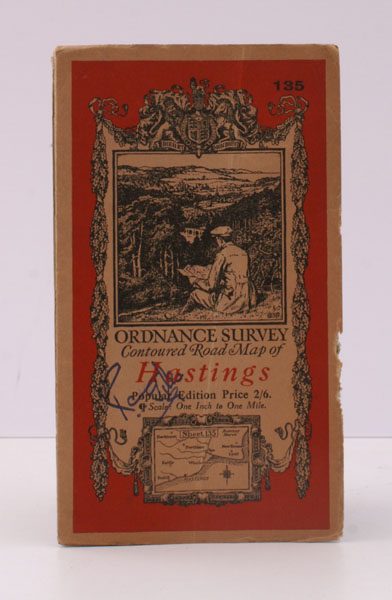
Ordnance Survey Contoured Road Map of Hastings
ORDNANCE SURVEY
Popular Edition. One Inch. Sheet 135. [Ellis Martin cover].
Published: Ordnance Survey [Southampton, 1933]
Stock code: 25804
Price: £16.00
Folding coloured map on cloth measuring 22.0 x 28.5 ins (approx. 56.0 x 72.0 cms) folding in 21 panels to 7.5 x 4.25 ins (approx. 19.0 x 11.0 cms), small neat contemporary signature on front wrapper else a very good, bright, clean copy.
The famous Popular Edition One Inch series was first published in 1919 with striking 'hiker' artwork by Ellis Martin. The present copy is the 1933 revision (roads and railways) of the 1921 impression; the covers are the dark red and black variant with location map. Browne, 11.2.a