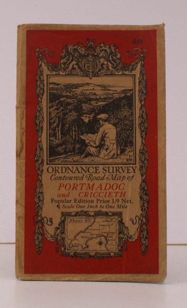
Ordnance Survey Contoured Road Map of Portmadoc and Criccieth
ORDNANCE SURVEY
Sheet 49. Scale: One Inch to to One Mile.
NEAR FINE COPY
Published: Ordnance Survey Southampton, [1933]
Stock code: 29846
Price: £22.00
Folding coloured map on cloth measuring 26 x 38 ins (approx. 66.0 x 96.5 cms) folding in 36 panels to 7.5 x 4.5 ins (approx. 17.7 x 10.1 cms); original pictorial card wrappers, a remarkably well-preserved, bright, clean copy.
The famous Popular Edition One Inch series with striking 'cyclist' artwork by Ellis Martin was first issued in 1920. This is the 1933 revision. The covers are black with red sheet name and location map. Browne, 11.1.a